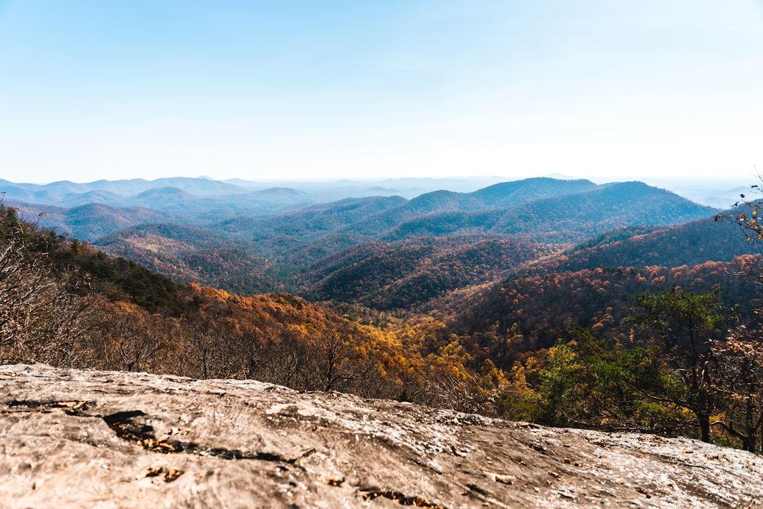
Georgia offers a diverse tapestry of hiking experiences, from the misty heights of the Blue Ridge Mountains to the dramatic depths of its canyons. Whether you’re seeking challenging ascents, family-friendly strolls, or the awe-inspiring beauty of cascading waterfalls, the Peach State has a trail to suit every adventurer. As you plan your 2026 hiking excursions, understanding current trail conditions, lengths, and accessibility is crucial for a safe and enjoyable outing.
| Trail Name | Location | Length | Elevation Gain | Difficulty | Key Features | Notes for 2026 |
|---|---|---|---|---|---|---|
| Amicalola Falls Trail (Loop & Stairs) | Amicalola Falls State Park | 8.8 miles (Loop); ~1 mile (Stairs Ascent) | ~1,000 ft (Loop); ~728 ft (Stairs) | Moderate to Strenuous | Georgia’s tallest waterfall (729 ft), 604 steps, AT Approach Trail access | Lower Falls Trail closed Nov 20 for improvements (duration several months). Stairs to falls crest are open. Expect crowds. |
| Blood Mountain via Appalachian Trail | North Georgia Mountains | 5 miles (Out-and-Back) | ~1,800 ft | Strenuous | Highest peak on the AT in Georgia, 360° summit views | No 2026 closures reported. Summit is exposed and can be windy/crowded. |
| Anna Ruby Falls Trail | Unicoi State Park | 3 miles (Out-and-Back) | ~400 ft | Easy to Moderate | Twin waterfalls, paved ADA-accessible path | No 2026 closures reported. Popular year-round. |
| Lookout Mountain Trail | Cloudland Canyon State Park | 2 miles (Loop) | Varies (significant stair descent/ascent) | Moderate to Strenuous | Canyon rim views, descent into canyon via stairs | No 2026 closures reported. Verify current park map for exact metrics. |
Amicalola Falls State Park: A Cascade of Options
Amicalola Falls State Park is home to Georgia’s tallest waterfall, plunging an impressive 729 feet. The park offers a variety of ways to experience this natural wonder, catering to different fitness levels and interests. The most iconic feature is the series of stairs ascending alongside the falls, providing a challenging yet rewarding climb.
The Amicalola Falls Loop and Stairs
The full Amicalola Falls Loop trail spans approximately 8.8 miles and is considered moderate to strenuous, with an elevation gain of around 1,000 feet. This loop offers a comprehensive exploration of the park’s diverse terrain. For those primarily interested in reaching the top of the falls, the stairs-only ascent is a popular, albeit demanding, option. This segment covers about 1 mile and features 604 steps, with an elevation gain of roughly 728 feet. While the stairs themselves are a significant physical undertaking, they offer unparalleled proximity to the thundering water.
Current Conditions and Safety
It is important for hikers to be aware of current conditions. As of November 20, the Lower Falls Trail, which provides access to the base of the waterfall, has been closed for major improvements and is expected to remain closed for several months. Fortunately, the stairs leading to the crest of the falls, which were previously damaged by a hurricane, have reopened after repairs. The West Ridge paved ADA trail also remains open year-round. Due to the park’s popularity, especially on weekends, expect crowds at the falls crest and along the stairs. Hikers should exercise caution, as the rocks and stairs can become slick when wet, and handrails may also be slippery. Swimming or climbing near the waterfall is strongly discouraged due to safety concerns.

Blood Mountain: Conquering Georgia’s Appalachian High Point
Blood Mountain stands as the highest peak on the Appalachian Trail (AT) within Georgia, offering a strenuous but immensely rewarding hiking experience. The ascent provides a significant physical challenge and culminates in panoramic views that stretch for miles.
The Ascent via the Appalachian Trail
The most common route to Blood Mountain’s summit is a 5-mile out-and-back hike, typically starting from trailheads like Woody Gap. This trail is characterized by a substantial elevation gain of approximately 1,800 feet, firmly placing it in the strenuous difficulty category. The path is rugged, featuring rocky terrain and steep sections that demand careful footing.
Summit Views and Weather Considerations
Upon reaching the summit, hikers are greeted with breathtaking 360-degree views of the surrounding North Georgia Mountains. However, the exposed nature of the peak means it can be windy and crowded, particularly during peak seasons. Hikers should be prepared for rapidly changing weather conditions, as thunderstorms are common in the spring and summer months. The granite steps and rocky surfaces can become treacherous when wet, underscoring the importance of appropriate footwear and caution. No specific 2026 closures have been reported for this section of the AT, indicating it remains open year-round.

Anna Ruby Falls Trail: Accessible Beauty in Unicoi State Park
Located within the scenic Unicoi State Park, the Anna Ruby Falls Trail offers a more accessible way to experience Georgia’s natural beauty, featuring twin waterfalls that cascade from the same cliff face. This trail is a favorite for families and those seeking a less strenuous outdoor adventure.
A Gentle Path to Twin Falls
The Anna Ruby Falls Trail is a 3-mile out-and-back hike with an elevation gain of about 400 feet, making it an easy to moderate excursion. A significant portion of the trail is paved and ADA-accessible, allowing individuals with limited mobility and families with strollers to enjoy the journey. The path winds through a lush forest, providing a pleasant walk before reaching the main attraction.
The Dual Waterfalls and Park Setting
The highlight of the trail is undoubtedly Anna Ruby Falls, where two distinct streams converge and plunge down a sheer rock face. The sound of the water and the cool mist create a refreshing atmosphere. Unicoi State Park itself offers numerous other recreational opportunities, making it a popular destination year-round. The trail is known to be very popular, so hikers can expect company, especially during peak times. No 2026 closures have been reported for this trail.

Cloudland Canyon State Park: Exploring the Depths
Cloudland Canyon State Park, situated on the western edge of the state, offers some of Georgia’s most dramatic scenery. The park’s namesake canyon is a breathtaking geological feature, and the hiking trails provide opportunities to explore both its rim and its floor.
Lookout Mountain Trail and Canyon Descent
The Lookout Mountain Trail is a popular loop within the park, offering spectacular views from the canyon rim. While the exact length and elevation gain can vary based on the specific route taken, a common loop is around 2 miles. The true challenge and reward of this trail often involve descending into the canyon itself. This descent typically involves a significant number of steep stairs, making it a strenuous undertaking. Hikers should verify the most current trail maps and conditions directly from the park’s official website.
Navigating the Stairs and Canyon Floor
The descent into Cloudland Canyon is often characterized by over 600 steps, requiring considerable physical exertion. These stairs can be slippery when wet, and the sheer drop-offs alongside the path demand focus and caution. Once at the bottom, the trail may lead past waterfalls and through the lush vegetation of the canyon floor. The return climb up the stairs is a demanding test of endurance. While no specific 2026 closures have been announced for the Lookout Mountain Trail, it is always advisable to check the park’s official resources for any last-minute updates or advisories.

Planning Your 2026 Georgia Hiking Adventures
When embarking on your hiking journeys in Georgia in 2026, thorough preparation is key. Understanding the specific characteristics of each trail, from its length and elevation gain to potential hazards and current accessibility, will significantly enhance your experience.
Leveraging Official Resources
For the most accurate and up-to-date information, always consult official sources. For trails within Georgia State Parks, the gastateparks.org website is an invaluable resource. For trails managed by the U.S. Forest Service or sections of the Appalachian Trail, resources like the Appalachian Trail Conservancy (appalachiantrail.org) and the U.S. Forest Service provide critical updates on trail conditions, closures, and regulations. Always check these sites before your trip.
Safety First on the Trail
Georgia’s trails, while beautiful, can present challenges. Be aware of weather patterns, especially in mountainous regions where conditions can change rapidly. Wear appropriate footwear with good traction, particularly for trails with steep ascents, descents, or rocky surfaces. Carry sufficient water, snacks, and a first-aid kit. Inform someone of your hiking plans, including your intended route and expected return time. For trails like Amicalola Falls and Cloudland Canyon, where stairs are a prominent feature, be mindful of slick surfaces when wet and pace yourself accordingly.
Frequently Asked Questions
What is the most challenging hike in Georgia?
While “most challenging” can be subjective, Blood Mountain via the Appalachian Trail is frequently cited due to its significant elevation gain and rugged terrain. The descent and ascent via stairs at Cloudland Canyon and Amicalola Falls also present considerable physical challenges.
Are there any trails in Georgia that are currently closed?
Yes, as of late 2023/early 2024, the Lower Falls Trail at Amicalola Falls State Park is closed for improvements and is expected to remain so for several months. Always check official park websites for the most current closure information.
Which Georgia hiking trails are suitable for families?
The Anna Ruby Falls Trail in Unicoi State Park is an excellent choice for families due to its paved, accessible path and relatively gentle terrain. Shorter, well-maintained rim trails at parks like Cloudland Canyon can also be suitable for families with younger children.
Do I need a permit to hike in Georgia?
Permits are generally not required for day hiking on most trails in Georgia State Parks or on the Appalachian Trail. However, specific activities, such as hiking to the gorge floor at Tallulah Gorge State Park, do require a permit, often obtained in advance. Always verify permit requirements for any specific destination.
What should I pack for a day hike in Georgia?
Essential items include plenty of water, high-energy snacks, a map of the trail, a compass or GPS device, a first-aid kit, sunscreen, insect repellent, a rain jacket, and appropriate hiking footwear. Dressing in layers is also recommended, especially for higher elevations where temperatures can fluctuate.