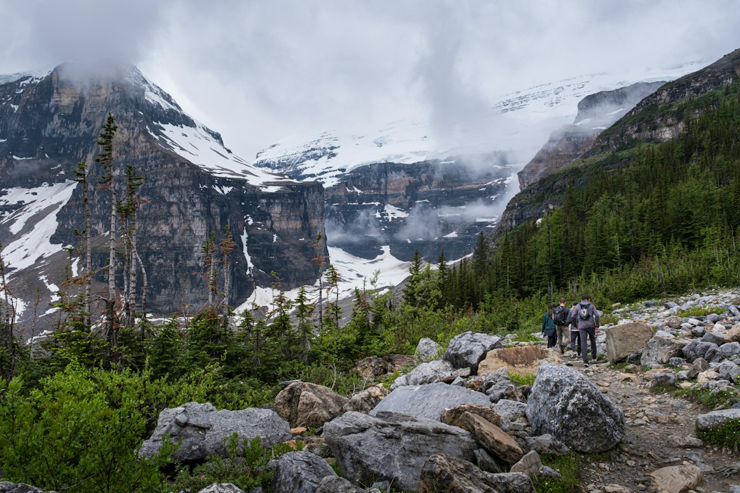
Top Backpacking Loops in Glacier National Park for 2026
Glacier National Park is a hiker’s paradise, offering some of the most breathtaking and challenging backpacking loops in North America. For 2026, planning your adventure means navigating a permit system, understanding seasonal conditions, and choosing a route that matches your experience level. This guide will highlight some of the best backpacking loops, providing essential information to help you prepare for an unforgettable journey through this iconic wilderness.
Many Glacier–Dawson Pass–Stoney Indian Pass loop
This extensive loop is a premier choice for seasoned backpackers seeking a comprehensive Glacier experience. It connects the popular Many Glacier area with Swiftcurrent Pass, Granite Park, and traverses high country near Dawson Pass before heading north towards Stoney Indian Pass. The route can be adapted into a true loop or a point-to-point trip with strategic transportation arrangements.
A classic itinerary commences near Many Glacier, ascending towards Swiftcurrent Pass and continuing through Granite Park. The trail then veers towards the Continental Divide, leading through expansive alpine terrain and descending towards the Belly River or Waterton-area trail network. The return journey can involve Red Gap Pass, the Ptarmigan Tunnel (permits and conditions permitting), or a lower valley connection. Precise campsite sequencing is crucial, as permit availability dictates the feasibility of even the most visually logical routes.
Why choose it: It offers an unusually complete cross-section of Glacier landscapes, with Swiftcurrent Pass and Stoney Indian Pass serving as major alpine milestones. The Many Glacier area is renowned for wildlife viewing, though this also heightens bear management concerns. The route accommodates various trip lengths, contingent on campsite and transportation alignment.
Challenges: The primary difficulty lies in the cumulative elevation change. A map can understate the effort required due to repeated climbs from lake basins to high passes and subsequent descents. Early-season snow can obscure switchbacks, while late-season storms can bring freezing temperatures, poor visibility, and fresh snowfall. The Many Glacier valley is also prone to access disruptions, as demonstrated by past temporary closures due to flooding, underscoring the need to verify trailhead access before and during your trip.
Best itinerary shape: Allow four to six days for the core route, adding an extra day for lengthy approaches, side trips, or weather contingencies. Avoid scheduling a major pass crossing on your final day before needing to depart, unless an alternative exit route is readily available.
Best for: Experienced hikers seeking the most varied classic route.
Do not underestimate: Elevation gain, campsite constraints, and transportation between trailheads.
Two Medicine–Dawson Pass loop
The Two Medicine area provides an efficient gateway to Glacier’s high country, suitable for backpackers looking for substantial scenery on a shorter expedition. A typical loop ascends from Two Medicine Lake towards Dawson Pass, traverses alpine terrain near the Continental Divide, and returns via a different drainage or along the North Shore trail network.
This trip appeals to backpackers desiring a shorter itinerary packed with scenic rewards, including clear mountain lakes, open meadows, steep walls, and sweeping views of the park’s eastern front. It can be designed as a three- or four-day trip, though shorter versions may require tight campsite availability and favorable weather.
What makes it accessible: Compared to longer northern loops, Two Medicine offers a more compact trailhead system. Its shorter scale simplifies food management, water sourcing, and scheduling. It’s an excellent choice for hikers transitioning to overnight travel, provided they are comfortable with steep terrain and unpredictable mountain weather. The pass itself demands respect; snowfields can persist well into summer, and afternoon thunderstorms can develop rapidly. Begin early, especially when crossing exposed terrain, and consider trekking poles for ascents and descents. Traction equipment may be advisable if firm snow is reported.
Suggested plan:
- Day 1: Approach from Two Medicine and camp in the assigned backcountry zone.
- Day 2: Climb toward Dawson Pass and continue to the permitted destination.
- Day 3: Return through an alternate drainage or established connecting trail.
- Day 4: Reserve as a weather or transportation buffer, if permits allow.
Do not assume improvisation between campsites is possible. Glacier’s permit system assigns specific camping locations; camping outside an authorized site is not an acceptable alternative for missed reservations.

Gunsight Pass loop and traverse
Gunsight Pass is one of Glacier’s most iconic high-altitude routes, typically connecting the Lake McDonald side with the St. Mary side via Gunsight Lake and Gunsight Pass. Popular campsites like Sperry and Gunsight are often incorporated into this traverse. While the separated trailheads naturally lend themselves to a point-to-point traverse, it can be configured into a loop with logistical planning involving transportation, connecting roads, or extended return routes.
The route is compelling for its condensed Glacier experience, encompassing dense forests, large lakes, hanging valleys, a historic backcountry chalet area, and a high pass beneath dramatic peaks. It is an excellent choice for hikers seeking a classic point-to-point journey rather than an out-and-back trek.
Logistics: Transportation is the central planning challenge. Leaving a vehicle at one trailhead necessitates arranging a shuttle or a second vehicle. Road distances around the park can be substantial, and public transportation options may be seasonal or limited. Develop your shuttle plan before applying for permits. Gunsight Pass can retain snow well after lower trails are clear. The pass is exposed, and wind can make even a warm forecast feel severe. Verify any trail closures due to bear activity, flooding, rockfall, or maintenance. A daily update in 2026, for instance, listed a closure affecting the Gunsight Lake–Gunsight Pass area due to bear activity, highlighting how even famous routes can become inaccessible without much notice.
Who should choose it: Opt for Gunsight Pass if your group is comfortable with sustained climbing, has reliable transportation, and can adapt to potential temporary route restrictions. It’s less suitable for a first overnight trip than routes like the Two Medicine loop due to the greater logistical complexity and exposure.
Best for: Strong hikers who want a signature Glacier traverse.
Primary risk: A closure or missed shuttle can create significant transportation challenges.
Belly River–Elizabeth Lake–Red Gap Pass loop
The Belly River system offers a more tranquil alternative to the busier southern park corridors. A multi-day route can link Belly River camps, Elizabeth Lake, Red Gap Pass, and connect towards Many Glacier or the park’s northern interior. Valley travel here is generally more gradual than the approaches to major passes, but the full loop becomes strenuous when incorporating higher passes and long connecting sections.
This route is an excellent selection for backpackers who value solitude, abundant wildlife habitat, and a more leisurely pace. The northern valleys feel more remote, and the route design encourages longer stays at individual campsites when permits allow. Elizabeth Lake stands out as a particularly memorable destination, featuring a broad water surface framed by steep mountains and a forested shoreline.
Wildlife and food storage: Remoteness does not equate to an absence of wildlife. Bears are prevalent throughout Glacier, and the park mandates strict management of food, garbage, and scented items. Utilize the approved food-storage systems at each campsite, maintain separate cooking and sleeping areas where required, and never leave food unattended. Carry bear spray where legally permitted and practical, know its deployment, and travel in groups. Make noise in dense vegetation and near running water, where approaching hikers may be difficult for wildlife to detect. Do not approach bears, photograph them from close range, or attempt to move around a bear blocking the trail. Adhere immediately to the park’s current wildlife closures.
Water and weather: Water is typically available in the valleys, but all clear mountain water requires treatment. Streams can swell rapidly after rainfall, and a crossing that was safe in the morning could become hazardous later in the day. Never attempt to cross a swollen channel solely to maintain an itinerary; wait, reroute, or retreat. Red Gap Pass and other high points may be snow-covered even when the lower Belly River is warm and dry. Prepare for a full spectrum of conditions, including rain, sleet, strong winds, and overnight temperatures near freezing.
North Fork–Kintla Lake–Bowman Lake loop
The North Fork region is ideal for backpackers seeking a less concentrated wilderness experience and who are prepared for more complex access. Kintla Lake, Bowman Lake, and the connecting valleys offer long-distance hiking possibilities, but the roads to the trailheads can be rough, slow, and vulnerable to weather. This route is best suited for hikers who enjoy logistical planning and do not require an extensive network of services.
A practical itinerary might involve using one lake as an entry point, traveling through connecting backcountry zones, and exiting near the other. Depending on the trail network and permit availability, the trip can be a true loop or a traverse supported by a shuttle. Distances are considerable, so carry ample food for potential delays and maintain a conservative pace.
Why it is worth the effort: Large lakes provide scenic campsites and opportunities for rest days. The area often feels quieter than Many Glacier and Lake McDonald. Longer valleys allow for gradual acclimatization before higher crossings. The route offers flexibility for four- to six-day trips when permits align. The trade-off is fewer straightforward bailout options. Cell service is inconsistent, road access may be limited, and a mechanical issue or injury could necessitate a long, self-supported exit. Every member of the group should be familiar with the route, the emergency plan, and turnaround criteria.

A flexible route built around Granite Park
Granite Park can serve as the focal point for shorter backpacking itineraries or as a segment within a larger loop. This area is accessible via the Highline or Swiftcurrent Pass corridors, depending on your starting point and current conditions. A trip centered on Granite Park can include excursions to Swiftcurrent Pass, scenic views along the Highline, and a return through a different trail system.
This option is effective when a group desires high-country scenery but struggles to secure a longer sequence of remote campsites. It also functions as a contingency plan when major northern or eastern routes become unavailable. The primary limitation is popularity; campsites and facilities in this corridor can be challenging to obtain. Exposed traverses demand particular care. Hikers with a fear of heights should understand the route’s character beforehand, and everyone should avoid traveling during lightning, severe wind, or low visibility. Snow on narrow sections can create conditions vastly different from dry-season photographs.
How to Plan a Glacier Backpacking Loop for 2026
Start with the permit, not the mileage
Glacier’s wilderness permit system dictates where an overnight group may camp each night. The most appealing route on a map is irrelevant if its required campsite sequence is unavailable. Prepare multiple route variations before applying: a preferred itinerary, a shorter alternative, and a lower-elevation backup. For 2026, confirm the current Recreation.gov lottery dates, group size restrictions, fees, and reservation windows. The park requires permits for all overnight backcountry camping, including trips utilizing only one campsite. Carry your permit at all times in the backcountry and adhere to the assigned dates, locations, and party size.
Choose the right season
Mid-July through early September generally represents the most practical window for accessing high passes, though the exact opening is contingent on snowpack and maintenance schedules. Earlier trips may encounter continuous snow, avalanche debris, unstable bridges, and swollen streams. September often brings fewer insects and cooler temperatures, but daylight shortens, and winter weather can arrive abruptly. Do not treat historical opening dates as guarantees. Check current trail reports, ranger station information, and the park’s closure notices immediately before your departure. In 2026, flooding caused temporary closures and affected access in multiple areas, reinforcing the necessity of checking conditions just prior to your trip.
Plan transportation carefully
Many of Glacier’s most exceptional routes are traverses rather than closed loops, often necessitating a shuttle between Lake McDonald, Many Glacier, Two Medicine, and St. Mary. Confirm pickup times, road access, parking regulations, and cancellation policies. If utilizing a private shuttle service, verify that it operates on your specific date and can still access the trailhead even if road conditions change.
Use conservative daily targets
Backcountry mileage in Glacier is not directly comparable to mileage on flat, maintained trails elsewhere. Elevation gain, heat, loose rock, snow, stream crossings, and heavy packs all reduce hiking speed. A group that comfortably covers 15 miles on a lowland trail might find 8 to 10 miles in Glacier to be a demanding endeavor. Allocate ample time for navigation, water treatment, meal preparation, wildlife encounters, and weather delays. Schedule high pass crossings for early in the day and establish firm turnaround times before leaving camp.
Safety Considerations Unique to Glacier National Park
Bears and other wildlife
Glacier is active grizzly and black bear habitat. Travel in groups, make your presence known in dense vegetation, secure all food, and maintain a clean camp. Bear spray should be readily accessible on a belt or chest strap, not buried in a backpack. Learn to distinguish between defensive and predatory bear behavior, but do not rely solely on species identification during a high-stress encounter. Mountain goats and bighorn sheep may also be encountered near trails and camps. Always give wildlife ample space, avoid blocking their escape routes, and never feed wild animals. Store salt-contaminated clothing and toiletries appropriately, as wildlife can be attracted to human scents.
Snow, lightning, and exposure
High passes can retain winter conditions long after valley trails have dried. Snow can obscure trail tread, create slippery traverses, or cover water channels. Determine if an ice axe, traction devices, or specific snow-travel skills are required; do not carry technical equipment without knowing how to use it. Thunderstorms develop rapidly over exposed ridges. If thunder is approaching, descend from ridgelines and isolated summits. Avoid sheltering beneath lone trees or near exposed rock faces. Heavy rain can trigger flash flooding, mudslides, rockfall, and unstable trail edges. Floodwater should never be crossed, even if it appears shallow.
Navigation and communication
Carry a paper map and compass in addition to a downloaded topographic map. GPS devices can fail due to battery depletion, tree cover, cold temperatures, or inaccurate track data. Satellite messengers can aid in emergency communication but do not replace essential route-finding skills or a realistic evacuation plan. Leave a detailed itinerary with a trusted individual, including trailheads, campsites, vehicle information, expected return time, and instructions for contacting emergency services. Establish a firm protocol for overdue individuals rather than relying on vague promises to “check in.”
Water crossings and injuries
Glacier’s streams are significantly influenced by snowmelt, rainfall, and the time of day. Cross streams early in the day when flows are lower, unbuckle your hip belt, face upstream, and use trekking poles for stability. If the current is powerful, the water is above your knees, or the landing is unstable, turn back. For injuries, stop promptly and assess the situation before it escalates. A minor ankle issue can become a serious evacuation challenge after several miles of descent. Carry a comprehensive repair kit, blister treatment, pressure bandages, pain medication suitable for your group, and sufficient insulation to treat someone who cannot continue hiking.
What to Pack for a Glacier Loop
Gear choices should align with your specific route rather than a generic ultralight checklist. A three-day trip in Two Medicine during stable weather may require less food and fewer spare layers than a remote North Fork itinerary with uncertain transportation. Essential items include:
- Topographic map, compass, and offline navigation device.
- Permit, identification, emergency contacts, and vehicle information.
- Bear spray carried where it can be reached immediately.
- Approved food-storage equipment as required by the park.
- Insulating layer, waterproof shell, gloves, and warm hat.
- Sun protection, including sunglasses, sunscreen, and a brimmed hat.
- Water treatment system with a backup method.
- Headlamp with spare batteries or a charged backup light.
- First-aid and repair supplies appropriate for the group.
- Trekking poles for steep descents and stream crossings.
- Satellite communicator or personal locator beacon for remote routes.
- Extra food for at least one unplanned overnight stay when access is difficult.
Footwear should be well broken in before the trip. Waterproof boots are not inherently safer; fit, traction, and drying time are more critical factors. Lightweight trail shoes may suffice for experienced hikers in dry conditions, but snow, mud, and pack weight might justify more supportive footwear.

Conclusion: Glacier National Park offers an unparalleled backcountry experience for backpackers. The loops outlined above provide a spectrum of challenges and rewards, from the demanding multi-day traverses of the north to the more accessible, yet still challenging, routes in the Two Medicine and Many Glacier areas. Thorough planning, adherence to park regulations, and a deep respect for the wilderness are paramount. For 2026, the key to a successful trip lies in securing permits early, understanding the dynamic seasonal conditions, and preparing for the unique safety considerations of this magnificent park. Whether you seek solitude, dramatic mountain scenery, or the thrill of traversing high alpine passes, Glacier National Park promises an unforgettable adventure.