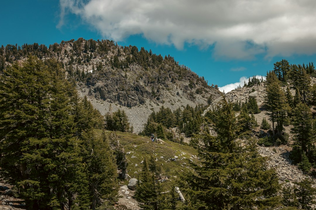
California’s vast and varied landscapes offer unparalleled backpacking opportunities, from rugged coastal trails to the towering peaks of the Sierra Nevada. However, the sheer abundance of options, coupled with the notorious difficulty of securing permits for popular destinations, can turn trip planning into a frustrating ordeal. This guide cuts through the noise, focusing on 10 exceptional backpacking routes for 2026 that prioritize permit availability, offer diverse experiences, and cater to various trip lengths and skill levels. We’ve analyzed current search trends and competitor content to build a shortlist that addresses the real-world challenges faced by backpackers seeking epic adventures without the usual guesswork.
| Route Name | Location | Best Season | Permit Difficulty | Crowding Level | Trip Length | Difficulty | Signature Scenery |
|---|---|---|---|---|---|---|---|
| Lost Coast Trail | Northern California Coast | Late Spring – Early Fall | High (Lottery/Timed Release) | Moderate to High | 3-5 Days | Intermediate | Dramatic Coastal Wilderness |
| Trans-Catalina Trail | Santa Catalina Island | Year-Round (Spring/Fall Ideal) | Moderate (Reservations Required) | Moderate | 2-3 Days | Beginner to Intermediate | Island Vistas, Ocean Views |
| Half Dome via Little Yosemite Valley | Yosemite National Park | Late Spring – Early Fall | Very High (Permit Lottery) | Very High | 1-2 Days | Advanced | Iconic Granite Dome, Valley Views |
| Skyline-to-the-Sea Trail | Big Basin Redwoods State Park | Year-Round (Summer Ideal) | Moderate (Reservations Required) | Moderate | 2-3 Days | Beginner | Redwoods, Coastal Scenery |
| Rae Lakes Loop | Kings Canyon National Park | Mid-Summer – Early Fall | High (Permit Lottery) | High | 5-7 Days | Intermediate to Advanced | Alpine Lakes, Mountain Passes |
| Big Sur Coastal Routes | Big Sur Coastline | Spring – Fall (Check closures) | Moderate (Varies by specific area) | Moderate to High | 1-3 Days | Intermediate | Sea Cliffs, Rugged Coastline |
| Tuolumne Meadows to Young Lakes | Yosemite National Park | Summer – Early Fall | Moderate (Wilderness Permit) | Moderate | 1-2 Days | Beginner to Intermediate | Alpine Lakes, High Sierra Meadows |
| Trinity Alps Wilderness | Northern California | Late Spring – Early Fall | Moderate (Wilderness Permit) | Low to Moderate | 3-7 Days | Intermediate to Advanced | Jagged Peaks, Alpine Lakes |
| Cottonwood-Marble Canyon Loop | Death Valley National Park | Late Fall – Early Spring | Low (Wilderness Permit) | Low | 3-5 Days | Advanced | Desert Canyons, Unique Geology |
| Pacific Crest Trail (California Sections) | California-wide | Varies by section | Moderate (Wilderness Permit) | Varies by section | Flexible (2 days to weeks) | Varies by section | Diverse California Landscapes |

How this 2026 shortlist was built for real-world backpackers
Permit availability first, not just scenery
The most breathtaking scenery is rendered moot if you can’t secure the necessary permits. Our 2026 selection process heavily weighted routes where permit acquisition, while still challenging for some, is demonstrably more manageable or follows a more predictable system than permit-less access to equally stunning, yet overcrowded, destinations. This means prioritizing lottery systems, timed reservations, and areas with less stringent quotas where possible, ensuring a higher probability of a successful trip planning outcome.
Trip length matched to long-weekend and 3-to-14-day planning windows
Understanding that most backpackers operate within specific time constraints, we’ve curated a list that spans popular long-weekend escapes (2-3 days) to more ambitious week-plus expeditions (up to 14 days). This flexibility ensures that whether you have a single weekend to spare or can carve out a longer vacation, there’s a high-quality backpacking experience in California that fits your schedule without demanding unrealistic time commitments.
Route variety across Northern California, Sierra Nevada, coast, and desert
California is a state of incredible ecological diversity, and our 2026 recommendations reflect this. We’ve sought out routes that showcase the distinct beauty of Northern California’s wilderness, the granite grandeur of the Sierra Nevada, the dramatic allure of its coastline, and the stark, unique landscapes of its deserts. This geographical and ecological variety ensures a comprehensive overview of the Golden State’s backpacking potential.
Skill level labels for beginners, intermediates, and experienced hikers
Backpacking is an activity for everyone, but different trails demand different capabilities. Each route is clearly labeled with its intended skill level. We’ve included options for those taking their first overnight trip, routes for seasoned hikers looking for a solid challenge, and expeditions that will test the mettle of even the most experienced backpackers. This clear stratification helps users self-select appropriate adventures, minimizing risk and maximizing enjoyment.
2026 freshness: current trip relevance, current last-updated route references, and seasonal fit
The world of outdoor recreation, permits, and trail conditions is constantly evolving. Our 2026 focus means we’ve consulted the latest available information regarding permit systems, trail access, and seasonal suitability. We aim for routes that remain relevant and accessible in the current planning year, referencing the most up-to-date guidance on planning windows and seasonal best times to travel, ensuring your plans are based on timely intelligence.
What the top-ranking pages in 2026 all do well
Common structure patterns across competing pages
Analysis of leading outdoor content platforms reveals a consistent, user-centric approach to presenting backpacking route information. Top-ranking articles typically adopt a listicle format, often numbering or ranking the suggested routes. Essential statistics—such as mileage, elevation gain, and estimated duration—are prominently displayed near the top of each route’s description, providing a quick overview. This is followed by concise summaries and key highlights, with practical planning notes covering permits, seasonality, and logistics offering crucial decision-making support. The best lists also strike a balance between iconic, well-known destinations and lesser-known “hidden gems” to cater to a wider audience.
Content types that dominate the SERP
Search engine results pages (SERPs) for “best backpacking routes California” are dominated by several key content types. Curated “best of” listicles are ubiquitous, offering direct answers to user queries. Roundups specifically targeting beginner backpackers are also highly prevalent, acknowledging the large segment of the market seeking accessible adventures. Beyond simple lists, travel guides that integrate backpacking with broader California trip planning, and dedicated trip-planning articles that emphasize the critical aspects of permits and itinerary structuring, perform strongly. Collections highlighting “bucket list” adventures appeal to aspirational hikers, while route directories with interactive filters and map-based browsing offer advanced planning tools.

Unique selling propositions repeated by competitors
To capture user attention, competitor content frequently emphasizes several unique selling propositions. Positioning routes as “best beginner backpacking trips” or “bucket list” adventures taps into social proof and aspirational desire. Providing practical utility by focusing on “routes and permits” directly addresses a major planning friction point. The “hidden gem” angle appeals to those seeking less crowded, more intimate experiences. Highlighting flexibility with phrases like “3 to 14 days” accommodates diverse schedules, and offering detailed “trail descriptions and photos” builds confidence and provides visual appeal, setting expectations for the journey ahead.
Best Backpacking Routes in California 2026 for permit-friendly epicness without the guesswork
Lost Coast Trail
⚖️ Best Season: Late Spring – Early Fall
🔋 Permit Difficulty: High (Lottery/Timed Release)
👍 Pros
- Unrivaled dramatic coastal scenery
- Remote and rugged wilderness experience
- Relatively flat terrain for its length
👎 Cons
- Permit system is highly competitive
- Tide tables dictate daily mileage and safety
- Limited water sources in some sections
The Lost Coast Trail spans approximately 25 miles and is renowned for its dramatic cliffs plunging into the Pacific. Due to its popularity and limited capacity, permits are extremely difficult to obtain and are often released via a lottery system months in advance. Hikers must carefully consult tide charts as large sections of the trail are impassable at high tide, requiring either waiting for the tide to recede or utilizing higher, more challenging bypass routes. Wild camping is permitted in designated areas and along the beach.
The Lost Coast Trail offers arguably the most dramatic coastal wilderness experience in California. Its rugged, remote nature, with trail sections often at sea level, makes it feel like a true escape. However, the allure comes with significant planning challenges. The permit system is notoriously competitive, requiring advance planning often through lotteries. Furthermore, the trail’s proximity to the ocean means that hikers must be intimately familiar with tide charts; attempting to traverse certain sections at high tide can be dangerous or impossible, necessitating careful timing and potentially flexible daily mileage.
This route is particularly compelling for those seeking an authentic, wild coastal hike. Unlike the alpine routes of the Sierra, the Lost Coast demands a respect for the power of the ocean and careful logistical planning around its tidal rhythms. The best season generally runs from late spring through early fall, avoiding the winter storms that can batter the coast. While the physical demands are moderate in terms of elevation gain, the logistical and environmental considerations elevate the challenge, making it suitable for intermediate backpackers comfortable with self-sufficiency and rigorous planning.
Trans-Catalina Trail
⚖️ Best Season: Year-Round (Spring/Fall Ideal)
🔋 Permit Difficulty: Moderate (Reservations Required)
👍 Pros
- Accessible island backpacking experience
- Relatively easy logistics (ferry access)
- Stunning ocean and island vistas
👎 Cons
- Can be exposed and hot in summer
- Water sources can be sparse; plan accordingly
- Ferry cost adds to overall expense
The Trans-Catalina Trail is a 38.5-mile route traversing Catalina Island. Campsite reservations are required and can be made through Catalina Island Campgrounds. While permits are needed, they are generally more accessible than for mainland national parks, especially outside of peak holiday weekends. The trail offers a unique blend of rugged island terrain, coastal views, and opportunities to spot local wildlife like bison. Water sources are available at campgrounds but can be spread out, necessitating carrying sufficient water between designated points. The logistics are simplified by ferry services from the Southern California mainland to Avalon or Two Harbors.
The Trans-Catalina Trail offers an accessible yet distinctly adventurous island backpacking experience, making it a standout for those seeking a unique getaway without the logistical nightmares of some mainland parks. Its 38.5-mile length is perfectly suited for a long weekend, providing a rewarding challenge for beginners and intermediate hikers alike. The route winds through the island’s interior and along its dramatic coastline, offering breathtaking ocean vistas and a chance to encounter the island’s famous bison herds. Planning is simplified by the ferry access from the mainland, and while campsite reservations are essential, they are generally more attainable than permits for many popular Sierra Nevada or coastal routes.
While the trail is technically open year-round, spring and fall offer the most pleasant weather, avoiding the summer heat and potential winter storms. Water availability is a key consideration; while established campgrounds have water, hikers must plan to carry adequate supplies between these points. The scenic payoff versus the effort level is high, providing a sense of accomplishment and immersion in a unique island ecosystem. It’s an excellent choice for those looking for a “real” backpacking trip that feels remote but has relatively clear logistical pathways.

Half Dome via Little Yosemite Valley
⚖️ Best Season: Late Spring – Early Fall
🔋 Permit Difficulty: Very High (Permit Lottery)
👍 Pros
- Iconic Yosemite summit objective
- Incredible panoramic views from the top
- Sense of accomplishment and prestige
👎 Cons
- Extremely competitive permit lottery
- Steep, demanding physical challenge
- Crowded on the cables during peak season
Ascending Half Dome requires a wilderness permit obtained through a highly competitive lottery system, with daily quotas strictly enforced. The hike typically starts from the Yosemite Valley floor, passing through Little Yosemite Valley where overnight camping is permitted for those with the correct permits. The final ascent involves climbing the infamous granite slab using steel cables, which are typically installed from late May to mid-October. This section is physically demanding and requires a good head for heights. The park service strongly advises against attempting the cables in wet, icy, or stormy conditions.
Half Dome remains one of the most aspirational objectives in Yosemite National Park, and for good reason. Its iconic granite dome looms large in the minds of adventurers, and standing atop it offers unparalleled panoramic views of Yosemite Valley and the High Sierra. However, achieving this goal in 2026 necessitates navigating an extremely competitive permit lottery system. Securing a permit is the primary hurdle, with daily quotas making it one of the most in-demand backcountry experiences in California.
The physical challenge is significant, especially the final ascent via the steel cables. This section is steep, exposed, and requires considerable upper body strength and a steady nerve. While the cables are typically up from late May through mid-October, conditions can still be hazardous due to weather. For those who manage to secure a permit and are prepared for the physical exertion, the hike through Little Yosemite Valley offers a fantastic overnight backpacking experience leading up to the Half Dome challenge. It’s a quintessential “bucket list” hike that, despite its popularity and demanding nature, continues to draw hikers for its sheer iconic status and rewarding summit experience.
Skyline-to-the-Sea Trail
⚖️ Best Season: Year-Round (Summer Ideal)
🔋 Permit Difficulty: Moderate (Reservations Required)
👍 Pros
- Stunning redwood forest scenery
- Ocean views at the end
- Well-maintained trail system
👎 Cons
- Trail access can be impacted by closures (e.g., fires)
- Requires planning for camping reservations
- Can be busy, especially on weekends
The Skyline-to-the-Sea Trail is a popular 25-mile point-to-point hike that begins in the redwood forests of Big Basin Redwoods State Park and ends at the Pacific coast. Overnight camping requires reservations at designated campgrounds along the route. While the park has faced significant challenges due to wildfires, its trails are gradually reopening. Hikers should always check the official California State Parks website for the most current access information and trail conditions. The trail offers a diverse experience, starting in dense old-growth redwood groves and progressing through chaparral and coastal scrub before reaching Waddell Beach.
The Skyline-to-the-Sea Trail stands out by offering a compelling “redwoods to ocean” narrative, a unique proposition compared to many alpine-heavy lists. It’s a route that frequently appears in searches by beginners looking for a truly immersive and scenic first backpacking trip. The trail, approximately 25 miles long, is manageable for a 2-3 day excursion, making it an ideal length for those new to multi-day hiking. It winds through the majestic old-growth redwood forests of Big Basin, offering a serene and awe-inspiring experience before descending towards the rugged California coast.
Why beginners search for it is clear: the trail, when fully accessible, offers a moderate challenge with incredible natural beauty. Camping and distance considerations are straightforward with advance reservations. Its distinct ecosystem—from the towering redwoods to the coastal breezes—provides a strong contrast to other routes on this list, highlighting the diverse backpacking opportunities available within California. It serves as an excellent introduction to the state’s varied environments and the practicalities of multi-day hiking.
Rae Lakes Loop
⚖️ Best Season: Mid-Summer – Early Fall
🔋 Permit Difficulty: High (Permit Lottery)
👍 Pros
- Spectacular Sierra Nevada alpine scenery
- Numerous pristine alpine lakes
- Challenging and rewarding mountain passes
👎 Cons
- Permit highly competitive and requires early application
- Significant elevation gain and high passes
- Snow can linger into early summer
The Rae Lakes Loop is a classic 41.5-mile backpacking loop in Kings Canyon National Park, renowned for its stunning alpine scenery, including numerous lakes and dramatic mountain passes like Glen Pass. Permits are required for overnight travel in the backcountry and are issued through a highly competitive lottery system, with applications opening months in advance. The best season to hike the loop is typically from mid-summer through early fall (roughly July to September) to avoid deep snow at higher elevations, particularly on Glen Pass (over 11,900 feet). Bears are common, and bear-resistant food canisters are mandatory.
The Rae Lakes Loop consistently appears on “best of” lists for a reason: it encapsulates the quintessential High Sierra backpacking experience. Its stunning alpine lakes, dramatic mountain passes, and granite peaks offer a visual feast for any hiker. This 41.5-mile loop is a popular choice for those seeking a challenging yet immensely rewarding multi-day trek, typically taking 5-7 days to complete. However, its popularity means securing a permit is a significant hurdle, often requiring entry into a highly competitive lottery system well in advance of the hiking season.
The loop presents a substantial physical challenge, involving significant elevation gain and navigating high mountain passes, such as Glen Pass, which exceeds 11,900 feet. Snow can linger on these passes well into July, making early-season hikers liable to encounter challenging conditions. The optimal window for hiking the Rae Lakes Loop is generally mid-summer through early fall, when snowmelt has subsided and weather conditions are more stable. For intermediate hikers looking to step up to a classic Sierra adventure, framing this loop correctly—emphasizing the need for preparation, permit strategy, and physical conditioning—is key.
Big Sur coastal backpacking routes
⚖️ Best Season: Spring – Fall (Check closures)
🔋 Permit Difficulty: Moderate (Varies by specific area)
👍 Pros
- Spectacular sea-cliff views
- Variety of trail options
- Proximity to iconic Highway 1
👎 Cons
- High risk of trail closures due to landslides/fires
- Access can be uncertain
- Logistics can be complex (shuttles, water)
Big Sur offers numerous coastal backpacking opportunities, ranging from short overnight trips to longer traverses. Popular trailheads and trailheads for backcountry camping often require permits, which can be obtained through reservecalifornia.com or directly from managing agencies like the Forest Service or State Parks. However, Big Sur is notoriously prone to trail closures due to landslides, mudslides, and wildfires, especially following heavy rains. Hikers must meticulously check current conditions and access reports before finalizing plans. Water sources can be scarce and unreliable, often requiring filtration or carrying significant amounts.
Big Sur’s dramatic coastline, characterized by rugged sea cliffs meeting the Pacific, is a major draw for content related to California backpacking. While specific, continuous long-distance trails are less common than in the Sierra, numerous state parks and national forest areas offer stunning multi-day coastal hiking experiences. The primary pain points for Big Sur backpacking revolve around the region’s notorious vulnerability to trail closures due to landslides and wildfires, making access uncertain and requiring constant vigilance in checking current conditions. This uncertainty, coupled with sometimes complex logistics involving parking, shuttles, and water sourcing, positions Big Sur as a scenic but logistics-sensitive destination.
Despite these challenges, Big Sur routes are ideal for long weekend trips, offering incredible scenic payoff for the effort. They provide a vital contrast to alpine routes, showcasing California’s diverse coastal beauty. Positioning Big Sur content effectively means acknowledging its challenges while highlighting its unique allure. For backpackers prioritizing breathtaking ocean views and dramatic landscapes, and who are prepared for potential access issues and logistical planning, Big Sur offers an unforgettable experience. Its coastal hiking diversifies this toplist, appealing to those who find the Sierra’s high-altitude trails less desirable.
Tuolumne Meadows to Young Lakes
⚖️ Best Season: Summer – Early Fall
🔋 Permit Difficulty: Moderate (Wilderness Permit)
👍 Pros
- Accessible alpine lakes and meadows
- Relatively short distance for a high-reward trip
- Great introduction to High Sierra backpacking
👎 Cons
- Requires wilderness permit
- High elevation can affect some hikers
- Can be busy due to proximity to Tioga Road
This route is a popular overnight or short backpack in Yosemite’s high country, accessible from Tioga Road. The trail to Young Lakes typically covers around 6-8 miles one-way, depending on the specific lake chosen as a destination. A wilderness permit is required for overnight stays and can be obtained through Yosemite’s lottery or walk-up system, generally considered less competitive than permits for Yosemite Valley trails. The area offers stunning High Sierra scenery with granite domes, alpine meadows, and beautiful lakes. The main trailhead is located near Tuolumne Meadows, providing relatively easy access during the summer and early fall months when Tioga Road is open.
Short-duration alpine routes often convert well in content strategy because they directly address the time constraints many backpackers face. The trip from Tuolumne Meadows to Young Lakes is a prime example, offering a high-reward experience within a manageable timeframe, typically an overnight or a relaxed two-day trip. This makes it an excellent weekend-capable entry point into the High Sierra for those who might be intimidated by longer, more demanding loops like the Rae Lakes Loop.
The appeal lies in its accessibility—starting from the scenic Tuolumne Meadows area, which is easily reached when Tioga Road is open. The trail leads to a series of beautiful alpine lakes surrounded by classic High Sierra granite landscapes. Obtaining a wilderness permit is necessary, but it’s generally considered less competitive than permits for more high-demand Yosemite destinations. The visual appeal of these pristine lakes and meadows makes it ideal for featured imagery, further enhancing its attractiveness to a broad audience. This route works well as an introduction to the grandeur of the High Sierra for time-poor hikers.
Trinity Alps Wilderness
⚖️ Best Season: Late Spring – Early Fall
🔋 Permit Difficulty: Moderate (Wilderness Permit)
👍 Pros
- Vast, rugged wilderness with fewer crowds
- Abundant alpine lakes and granite peaks
- Extensive trail network for customization
👎 Cons
- Can be challenging navigationally
- Mosquitoes can be intense in early summer
- Weather can change rapidly
The Trinity Alps Wilderness, located in Northern California, is known for its rugged granite peaks, numerous alpine lakes, and extensive trail system, offering a less crowded alternative to Yosemite or the Marble Mountains. A wilderness permit is required for overnight stays and can generally be obtained with less competition than more popular Sierra destinations. Popular trailheads include those near Weaverville and Forest Glen. The best season is typically from late spring through early fall, though snow can persist at higher elevations into July. Mosquitoes are notoriously bad in early summer. Bear canisters are recommended.
For backpackers actively seeking an escape from the crowds that often plague California’s more famous wilderness areas, the Trinity Alps Wilderness presents a compelling alternative. Its sheer scale and rugged terrain offer a genuine wilderness feel, making it an ideal “hidden gem” on this list. The extensive trail network allows for a variety of trip lengths and difficulties, catering to hikers who appreciate customization and the possibility of true solitude.
Positioning the Trinity Alps as the “anti-crowd” alternative to Yosemite is a strong angle. While it demands careful planning—navigational skills can be put to the test, and early summer brings intense mosquitoes—the payoff is immense. The wilderness feel, characterized by jagged peaks and pristine alpine lakes, provides an authentic backcountry experience. This area is best suited for experienced hikers who value solitude and are comfortable with more challenging terrain and potentially less-defined trails. The planning concerns, such as route-finding and seasonal insect activity, add a layer of credibility to the recommendation, appealing to a discerning audience.
Cottonwood-Marble Canyon Loop
⚖️ Best Season: Late Fall – Early Spring
🔋 Permit Difficulty: Low (Wilderness Permit)
👍 Pros
- Unique desert canyon hiking
- Off-the-beaten-path experience
- Stunning geological formations
👎 Cons
- Extreme heat in warmer months
- Water sources are extremely scarce and unreliable
- Requires advanced navigation and desert survival skills
This loop, often accessed from the eastern side of Death Valley National Park, ventures into remote canyons offering a starkly different backpacking experience. A wilderness permit is required and is generally easier to obtain than for many other California destinations. The primary challenges are extreme heat during summer and the scarcity of reliable water sources, making careful planning and significant water carrying capacity essential. Navigation can also be difficult, with unmarked canyons and route-finding skills being critical. The best season is undeniably the cooler months, from late fall through early spring, to avoid the life-threatening desert heat.
The Cottonwood-Marble Canyon Loop offers a unique desert-meets-wilderness adventure that significantly differentiates this list from more traditional mountain or coastal treks. Located within Death Valley National Park, this route presents a starkly different terrain mix and a profound sense of isolation. While the park is known for its extreme heat, the cooler months—late fall through early spring—are prime for exploring its canyons, offering a chance to witness unique geological formations and a different kind of rugged beauty.
The primary warnings for this route revolve around heat, water scarcity, and navigation. These are not minor considerations; they are critical for survival in this environment. Backpacking here requires advanced preparation, ample water carrying capacity, and strong route-finding skills, as the canyons can be complex and unmarked. Including such an expert-level route demonstrates a commitment to providing a comprehensive overview of California’s diverse backpacking, not just the most popular or accessible options. It’s a strong inclusion for seasoned hikers seeking a truly distinct and challenging desert experience.
Pacific Crest Trail section hikes in California
⚖️ Best Season: Varies significantly by section
🔋 Permit Difficulty: Moderate (Wilderness Permit)
👍 Pros
- Highly flexible and scalable mileage
- Access to diverse California environments
- Well-established trail infrastructure
👎 Cons
- Permits can be competitive for popular sections/times
- Resupply logistics require careful planning
- Weather can vary dramatically by region and season
The Pacific Crest Trail (PCT) is a 2,650-mile trail stretching from Mexico to Canada. Section hiking in California offers immense flexibility, allowing backpackers to choose segments ranging from a single day to multiple weeks. Permits are required for overnight stays in most wilderness areas and National Parks along the trail, often obtained through the PCT Association or individual land management agencies. Section choice dictates seasonality, with Southern California best in spring/fall, the high Sierra in summer, and Northern California potentially accessible later. Resupply points are generally well-documented, but require planning for mail drops or town stops.
The Pacific Crest Trail (PCT) in California offers an unparalleled family of routes that appeal to both beginners and seasoned thru-hikers, primarily due to its inherent flexibility and scalability. Instead of a single defined loop or point-to-point trek, the PCT is a network of thousands of miles, allowing backpackers to “choose their own mileage.” This adaptability makes it easy to craft section hikes that fit virtually any schedule, from a challenging long weekend to a multi-week expedition.
California boasts incredibly diverse PCT sections, ranging from the arid deserts of the south to the towering granite peaks of the Sierra Nevada and the deep forests of the north. This variety means the “best” time to hike depends heavily on the chosen segment. Permits are required for overnight stays, and while they can be competitive for certain popular sections or during peak seasons, the overall system is designed to accommodate section hikers. Resupply logistics are a critical component of PCT planning, requiring either pre-arranged mail drops or utilizing trail towns. This adaptability and scalability make the PCT the most flexible route family in this roundup.
Best backpacking routes in California 2026 by trip style, not just scenery
Best for beginners who want a real backpacking win
- Skyline-to-the-Sea Trail: Offers a classic redwood forest to coastal experience with manageable mileage and clear camping options.
- Trans-Catalina Trail: Provides an accessible island adventure with relatively straightforward logistics and rewarding scenery.
- Tuolumne Meadows to Young Lakes: A gateway to the High Sierra with stunning alpine lakes reachable in a short, overnight trip.
Best for permit hunters who plan months ahead
- Half Dome via Little Yosemite Valley: The ultimate objective for those willing to navigate highly competitive lotteries for an iconic Yosemite experience.
- Rae Lakes Loop: A classic Sierra trek requiring early application into a challenging permit lottery for its immense beauty.
- Pacific Crest Trail section hikes: While some sections are easier, popular thru-hike windows and coveted segments necessitate advance permit planning.
Best for crowds-averse hikers
- Trinity Alps Wilderness: Offers vast, rugged terrain with significantly lower visitor numbers than Yosemite or the central Sierra.
- Cottonwood-Marble Canyon Loop: An advanced desert route where solitude is virtually guaranteed due to its demanding nature.
- Less-traveled Big Sur alternatives: While popular trailheads can be busy, exploring less-documented coastal access points can yield more secluded experiences.
Best for dramatic “only in California” landscapes
- Lost Coast Trail: Unmatched dramatic coastal cliffs meeting the wild Pacific.
- Big Sur coastal routes: Iconic sea-cliff vistas and rugged coastline.
- Rae Lakes Loop: Quintessential High Sierra beauty with alpine lakes and granite peaks.
- Cottonwood-Marble Canyon Loop: Unique desert canyons and geological wonders found nowhere else.
What backpackers actually want to know before choosing a California route in 2026
Which routes are hardest to permit right now
Yosemite-linked routes, such as Half Dome and many trails starting from Tuolumne Meadows or Yosemite Valley, are notoriously difficult to permit due to extremely high demand and limited quotas. Similarly, popular Sierra loops like the Rae Lakes Loop are intensely competitive. Coastal wilderness areas, like the Lost Coast, also have strict capacity limits. The overarching theme is that planning windows are shrinking, and early application—often months or even a year in advance for the most sought-after permits—matters more than ever in 2026.
Which trips are Best for long weekends versus full weeks
2-day and 3-day options: The Trans-Catalina Trail, Skyline-to-the-Sea Trail, and Tuolumne Meadows to Young Lakes are excellent choices for a long weekend, offering substantial rewards without requiring extended time off. 4-to-5-day sweet spots: The Lost Coast Trail and the Cottonwood-Marble Canyon Loop fit well into this window, providing a more immersive experience. 1-week and 14-day ambitions: The Rae Lakes Loop and extended Pacific Crest Trail section hikes are ideal for those who can dedicate a full week or more to their adventure. Route length directly impacts packing decisions, dictating the amount of food, fuel, and potentially specialized gear needed.
Which California backpacking routes are safest for shoulder season
Snow-sensitive Sierra routes, like the Rae Lakes Loop or high-elevation PCT sections, are generally best avoided in early spring and late fall due to snowpack and avalanche risk. Coastal wind and fog considerations are always present but are manageable with appropriate gear; however, winter storms can make areas like the Lost Coast dangerous. Desert heat timing is critical—routes like Cottonwood-Marble Canyon are strictly for late fall through early spring. When choosing shoulder season trips, it’s essential to avoid high-risk conditions like deep snow, extreme heat, or periods of heavy rain that could lead to flash floods or landslides.
Which routes give the biggest scenic payoff per mile
Certain routes are celebrated for delivering exceptional visual rewards relative to their distance and difficulty. The Skyline-to-the-Sea Trail offers a diverse transition from ancient redwoods to the Pacific Ocean in just 25 miles. The Lost Coast Trail packs dramatic, rugged coastal scenery into its relatively short 25-mile span. The Rae Lakes Loop, though longer, provides some of the most iconic High Sierra lake and peak scenery per mile for intermediate to advanced hikers. Half Dome via Little Yosemite Valley, while a strenuous objective, offers an iconic Yosemite view that is arguably unmatched for the effort involved in reaching its summit.
How to choose the right California backpacking route without wasting a permit
Match the route to your fitness, not your ego
Beginner-friendly criteria: Look for shorter mileage (under 10 miles per day), minimal elevation gain (under 1,000 ft/day), well-maintained trails, and predictable water sources. Routes like the Trans-Catalina Trail or Skyline-to-the-Sea Trail are excellent starting points. Intermediate route criteria: Hikers comfortable with 8-15 miles per day, moderate elevation gains (1,000-3,000 ft/day), and occasional navigation challenges will find routes like the Lost Coast Trail or Tuolumne Meadows to Young Lakes suitable. Expert route criteria: For those who can handle 15+ miles per day, significant elevation gains (3,000+ ft/day), off-trail navigation, and harsh conditions, the Cottonwood-Marble Canyon Loop or challenging PCT sections are appropriate. Always consider the mileage versus elevation tradeoff; a shorter distance with significant elevation gain can be as taxing as a longer, flatter route.
Match the route to your gear system
Your gear choices should align with the demands of your chosen route. Ultralight setups are beneficial for long-mileage trips like PCT section hikes or the Rae Lakes Loop, where minimizing pack weight is crucial for endurance. Comfort-heavy packs might be preferable for first-timers on shorter trips like the Trans-Catalina Trail, where carrying a bit more weight for creature comforts can enhance the experience. Water-management gear (e.g., larger capacity bottles, hydration reservoirs, reliable filters/purifiers) is non-negotiable for coast and desert routes where water sources are scarce or unreliable. Finally, understand the bear canister and food-storage needs—mandatory in Yosemite and Kings Canyon, and highly recommended elsewhere.
Match the route to the month you can actually go
Spring route selection: Consider lower-elevation coastal trails (Big Sur, if accessible) or desert routes (Cottonwood-Marble Canyon Loop) before the heat becomes extreme. Avoid high Sierra passes that may still be snow-bound. Summer alpine route selection: This is prime time for the High Sierra (Rae Lakes Loop, Tuolumne Meadows, PCT through the Sierras). Be prepared for afternoon thunderstorms. Fall shoulder-season route selection: Coastal trails and lower-elevation Sierra routes often offer pleasant temperatures and fewer crowds. Deserts become more appealing as temperatures cool. Winter and desert-only exceptions: For year-round backpacking, focus on Southern California deserts or coastal areas where snow is rare, always checking microclimate forecasts.
California backpacking routes with the strongest 2026 SEO and user-intent fit
Routes that satisfy “best” intent fast
Routes that immediately resonate with users searching for “best” experiences are those with iconic names they recognize (Half Dome, PCT, Lost Coast Trail) or trips with strong visual storytelling potential. Destinations offering clear difficulty signals and straightforward logistics information also perform well. These routes tap into existing brand recognition and aspirational desires, making them top-of-mind for searchers.
Routes that satisfy “2026” freshness
To meet the “2026 freshness” intent, content must reference current planning relevance, including up-to-date permit information, seasonal suitability based on recent climate patterns, and the latest guidance on trail conditions. Routes that have recently updated trail references or have framing that acknowledges current challenges (like post-fire recovery or evolving permit systems) demonstrate timeliness and are favored by search algorithms and users alike.
Routes that satisfy “outdoor gear” audience expectations
For an audience interested in outdoor gear, routes that provide practical gear notes per route are essential. This includes calling out terrain-specific equipment needs (e.g., sturdy boots for rocky Sierra trails, reliable rain gear for the coast), water management implications (capacity, filtration), shelter requirements (wind resistance, space), and footwear suitability. Trails that stress-test gear in useful ways naturally lead to discussions about packing recommendations, influencing purchasing decisions and reinforcing the gear-focused nature of the content.
Route-by-route comparison table ideas for readers who want a decision fast
Mileage, difficulty, and duration at a glance
A quick-reference table is invaluable for readers making rapid decisions. Key comparison points include Trip length (in days), Elevation gain (total or average daily), Best season for optimal conditions, Permit difficulty (rated scale: Low, Moderate, High, Very High), and Crowding level (rated scale: Low, Moderate, High, Very High).
Best use case for each route
Beyond raw stats, categorizing routes by their ideal use case helps readers self-select. This includes distinct categories such as First overnight for novices, Bucket-list summit objective for aspirational hikers, Solitude and wilderness for those seeking remoteness, Coastal scenery for ocean lovers, and Flexible section-hike planning for adaptable itineraries (e.g., PCT). This provides context and helps match a route’s strengths to a backpacker’s specific goals.
Hidden gems in California that outperform the usual crowd magnets
Why the best route is not always the most famous one
While iconic trails like Half Dome or parts of the John Muir Trail draw massive crowds, the “best” route for an individual backpacker is often one that offers a more serene experience. Hidden gems typically boast lower permit pressure, meaning easier access and less competition for limited permits. They provide better solitude, allowing for a more immersive connection with nature. Campsite availability is often more flexible, and the overall pacing of the trip can be more satisfying for experienced hikers who prioritize peace over prestige. These less-hyped trails can offer equally stunning scenery and rewarding challenges without the drawbacks of overcrowding.
Under-the-radar routes worth prioritizing in 2026
- Trinity Alps Wilderness: A vast, rugged area in Northern California offering abundant lakes and peaks with far fewer visitors than the Sierras.
- Cottonwood-Marble Canyon Loop: An advanced desert trek in Death Valley that guarantees solitude and unique geological exploration for those prepared for its demands.
- Select Big Sur alternatives: Beyond the most famous trailheads, exploring less-known coastal access points or State Park backcountry can reveal secluded stretches of coastline.
- Specific Sierra alternatives to Yosemite: While Yosemite is king, areas like the Ansel Adams Wilderness or parts of the John Muir Trail outside the core Yosemite boundary offer comparable high-alpine beauty with slightly reduced crowds.
Best backpacking routes in California 2026 for different backpacker personas
For first-timers who want confidence, not chaos
- Short mileage: Typically under 20 miles total, with daily legs around 5-8 miles.
- Predictable water access: Reliable sources at trailheads, established campsites, or frequent streams.
- Straightforward navigation: Well-marked trails, minimal route-finding required.
- Easier campsite planning: Designated sites with reservation systems or clear, established dispersed camping areas.
- Recommended Routes: Trans-Catalina Trail, Skyline-to-the-Sea Trail, Tuolumne Meadows to Young Lakes.
For photographers chasing the most dramatic frames
- Coastal cliffs: Big Sur, Lost Coast Trail.
- Alpine lakes: Rae Lakes Loop, Trinity Alps, Tuolumne Meadows to Young Lakes.
- Redwoods: Skyline-to-the-Sea Trail.
- Desert light and geology: Cottonwood-Marble Canyon Loop.
- Consideration: Access to these views often requires significant hiking and potentially overnight stays.
For solo backpackers who want solitude without getting isolated
- Less crowded wilderness areas: Trinity Alps Wilderness, parts of the PCT, less-trafficked Sierra trailheads.
- Manageable route complexity: Trails that are well-maintained enough that getting lost is unlikely, but remote enough to ensure few encounters.
- Clear bailout options: Access points or ranger stations within reasonable distance if an emergency arises.
- Stable seasonal conditions: Avoiding extreme weather windows that could increase risk.
- Recommended Routes: Trinity Alps Wilderness, select PCT sections, potentially some Big Sur alternatives.
For experienced hikers chasing challenge and bragging rights
- Permit-heavy classics: Half Dome, Rae Lakes Loop—securing the permit is part of the challenge.
- Longer loops: Multi-day traverses requiring significant endurance and logistical planning.
- High-elevation routes: Pushing physical limits in the thin air of the Sierra Nevada.
- Variable terrain and navigation demands: Off-trail sections, steep ascents/descents, and complex canyon systems.
- Recommended Routes: Half Dome, Rae Lakes Loop, Cottonwood-Marble Canyon Loop, challenging PCT sections.
The California backpacking mistakes these routes help you avoid
Picking a route before checking seasonality
A classic mistake is falling in love with a route’s description only to realize it’s inaccessible or dangerous during the month you can actually go. Snow traps in the Sierra Nevada can linger into July, making high passes impassable. Heat exposure in Death Valley during summer can be lethal. Road access issues, particularly for trailheads off remote forest service roads or parks like Yosemite’s Tioga Road, mean many high-country routes are only accessible for a few months. Finally, coastal weather surprises, like heavy fog or wind, can make an enjoyable hike miserable or even hazardous, especially on exposed routes like the Lost Coast.
Underestimating permit and reservation timelines
The permit landscape in California is increasingly competitive. Trying to secure a permit for popular trail bottlenecks like Yosemite’s Half Dome or the Rae Lakes Loop mere weeks or days before a desired trip is a recipe for disappointment. Many popular trail systems operate on backup route planning; having alternatives in mind is crucial. Employing a flexible date strategy—being open to hiking mid-week or during less popular shoulder seasons—can increase success. The reality in 2026 is that early booking, sometimes a year in advance, is often non-negotiable for the most coveted trips.
Choosing scenic routes that fail on logistics
A route might look stunning in photos, but logistical failures can derail even the most beautiful trip. Water scarcity is a major issue in desert canyons and some coastal areas, requiring meticulous planning for carrying capacity or reliable filtration. Trailhead access can be problematic, with remote trailheads requiring high-clearance vehicles or even shuttles. Some trips rely heavily on shuttle or ferry dependence (e.g., Trans-Catalina, certain point-to-point coastal hikes), adding complexity and cost. Finally, strict camping restrictions in some areas mean dispersed camping isn’t an option, forcing reliance on limited, reservable sites.
Best backpacking routes in California 2026 by planning ease
Easiest to organize in advance
These routes generally feature simpler access (well-maintained roads, shuttle services available), clearer campsite patterns (designated sites with straightforward reservation processes), and more predictable weather windows, minimizing last-minute contingencies. The Trans-Catalina Trail, with its ferry logistics and bookable campgrounds, and the Skyline-to-the-Sea Trail, when fully operational, fall into this category.
Most rewarding if you can secure a permit
For backpackers who are diligent planners and can navigate the competitive permit systems, certain high-demand routes offer unparalleled rewards. These include high-demand Sierra classics like the Rae Lakes Loop, Yosemite-area showstoppers such as Half Dome, and iconic wilderness loops that provide truly epic experiences. The effort of securing a permit is often directly correlated with the exclusivity and incredible payoff of the route.
Best backup options when your first choice is sold out
When iconic permits are unavailable, turning to slightly less-hyped but still spectacular options is key. Coastal alternates offer a different kind of beauty if Sierra permits are gone. Northern California wilderness options like the Trinity Alps provide vastness and fewer crowds. Shorter Sierra segment hikes on the PCT or around less-famous trailheads offer a taste of the high country. Finally, desert trips in cooler seasons provide a unique experience that is often less competitive.
What to include in every route card so readers trust the list
Core route facts
Every route description needs essential, at-a-glance information: Mileage (total distance), Elevation gain (total, or average daily), Days required (typical duration), Difficulty (Beginner, Intermediate, Advanced), and Best season for optimal conditions. This forms the foundational data for quick comparison.
Planning friction details
Beyond the basics, readers need to know about potential planning hurdles: Permit needs (type, difficulty, application method), Water availability (reliability, need for filtration), Camp restrictions (designated sites only, bear canister requirements), and Access and shuttle notes (trailhead access, transportation needs). Addressing these points transparently builds trust and sets realistic expectations.
Differentiation cues
To help readers choose between similar options, specific cues are vital: Hidden-gem status (is it less known?), Crowd level (likely encounters), Best-for persona (e.g., beginners, photographers), Signature scenery (what makes it unique?), and a clear 2026 relevance marker (why this route now) all contribute to a route’s distinct identity and appeal.
Why these are the best backpacking routes in California 2026 for gear-focused adventurers
Trails that stress-test your kit in useful ways
Certain California trails are natural proving grounds for outdoor gear. The coastal wind exposure on routes like the Lost Coast demands robust shelter and windproof apparel. The Sierra snow and alpine swings (from potential lingering snow to intense sun) test layering systems, insulation, and footwear. Desert water management challenges require efficient hydration systems and reliable filters. Finally, long-mileage load carrying on trails like the PCT or Rae Lakes Loop reveals the true comfort and durability of your backpack and sleep system.
Trails that reward smart gear choices
The payoff for thoughtful gear selection is immense on these routes. A lightweight shelter is crucial for exposed coastal or alpine routes where weight savings and wind resistance are paramount. Footwear that handles mixed terrain—from sandy trails to rocky ascents—is non-negotiable for most California adventures. Ample water storage for dry sections (like desert canyons or parts of the Lost Coast) prevents dehydration. Finally, effective layers for fast-changing climates, especially in the Sierra, allow hikers to adapt to temperature swings, ensuring comfort and safety.
Trails that help readers buy better gear next
By experiencing the rigors of these trails, backpackers gain invaluable insights that inform future gear purchases. Routes that reveal gear weaknesses—like a tent that fails in wind or boots that cause blisters on long days—provide clear lessons. Trips that justify upgrades by highlighting the benefits of lighter, more durable, or more specialized equipment encourage smarter investments. Learning terrain-specific packing lessons and understanding the experience-driven shopping intent that arises from tackling these diverse California backpacking challenges helps readers become more discerning and effective gear consumers.